Map: River Starliper
Item
-
Title
-
Map: River Starliper
-
Description
-
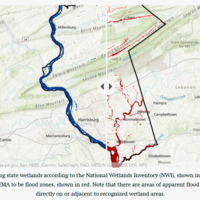
Physical Description: Screenshot of an ArcGIS map in which FEMA projected flood zones are compared to recognized wetlands in Dauphin county, Pennsylvania.
-
Contextul Description: Part of a larger StoryMap project in which mappable data from multiple sources was combined and overlaid in ArcGIS to predict areas of potential flood hazard and recommend alterations that should be made to existing FEMA maps. The original project is no longer available online, and its resources are only backed up on a hard drive in Pennsylvania. This project was completed as an assignment for Applications of GIS in the fall 2021 semester at RIT, and the idea for the project topic came from the 2011 historic flooding that impacted areas of lower Dauphin county.
-
Date Entered Collection
-
November 25, 2022
-
Date Created
-
December 6, 2021 – December 6, 2021
-
Medium
-
Digital image
-
Extent
-
2221_MUSE340
-
Spatial Coverage
-
n/a
 gismap.PNG
